Projects
Experienced Geophysical Services in Alaska
Read on for details on project types that have been successfully completed in the past.
Mobile drilling platform site assessment
Our team has performed numerous geohazard site assessments for drilling programs in Cook Inlet, Chukchi Sea and the Beaufort Sea. WCI performs all program aspects including: project management, planning, mobilization, data acquisition and processing, interpretation and reporting. Site assessment surveys acquire intermediate and Common Depth Point (CDP) seismic data to investigate shallow gas and other potential hazards to depths of 2,000 to 5,000 feet. Processing of CDP data is undertaken while at sea to assure quality. Data and final reports were presented to government agencies on behalf of our clients in order to facilitate permitting efforts. Final reports and processed data are presented to meet Alaska Oil and Gas Conservation Commission (AOGCC) or to meet the Federal Government's criteria. WCI has conducted more Cook Inlet shallow gas hazard surveys than any other Alaskan firm.
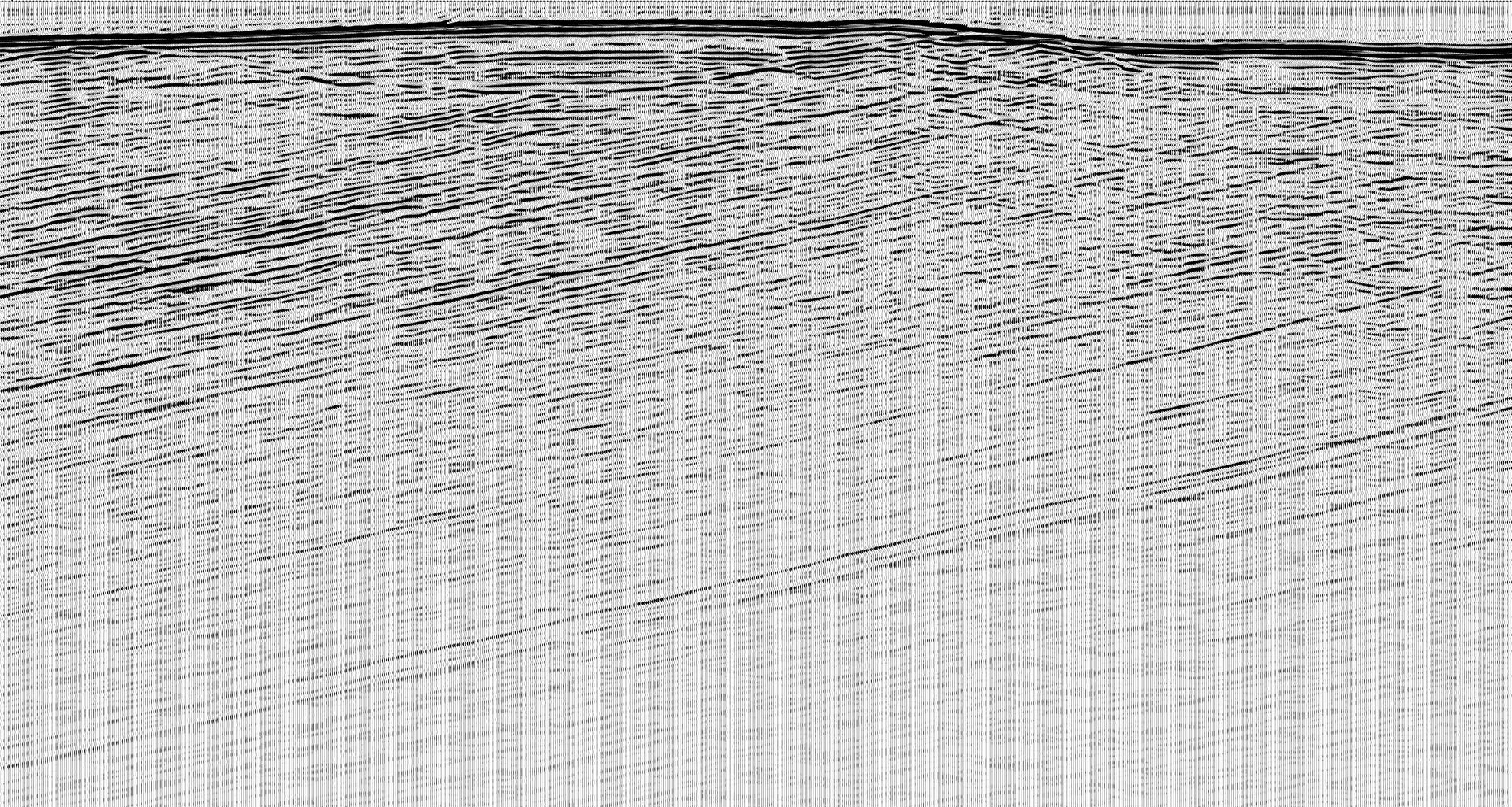
CDP Section Example from Seafloor to over 3,000 feet
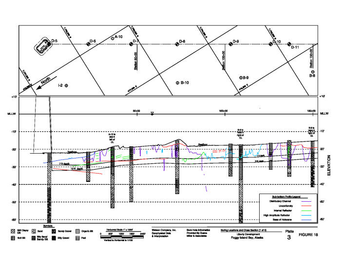
Pipeline route surveys - example of Cook Inlet pipeline span
Watson Company Inc. has extensive experience in conducting geophysical pipeline route surveys in Cook Inlet, the Aleutian Islands, and the Beaufort Sea. These generally include investigation of the seafloor and shallow sub-bottom conditions for geologic or man-made materials that would affect offshore pipeline design, installation or operations. In general, we use the following suite of equipment: intermediate seismic, full spectrum sub-bottom profiler, side scan sonar, and multi-beam bathymetric sonar. WCI was the prime contractor for the NANGPG Trans-Arctic Pipeline feasibility study, commencing from Prudhoe to the Canadian Arctic. The project included 3-vessels, involved 30-personnel and spanned over 300 miles.
Arctic Offshore site assessment
Working in the Arctic presents a host of challenges for offshore geophysical operations. Floating ice and shallow water are factors often encountered during data acquisition. WCI began working in the Arctic on the Northstar Island project in 1985. WCI has been contracted to conduct shallow hazard site assessments for multiple programs in the Beaufort and Chukchi Seas. Shallow gas and other hazards are required to be mapped to understand the viability of a site specific location. WCI role in pipeline geophysical data acquisition programs included; project management, planning, mobilization, survey layout and survey execution.
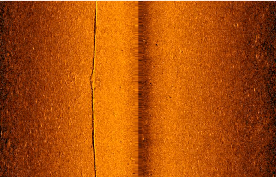
Outfall surveys
Mapping of outfall areas is critical in nearshore environments where delicate pipelines, transmission cables or diffusers are present. Watson pioneered the integration of bathymetric data over seafloor imagery to determine outfall conditions on steep geologic terrain. 3-dimensional models were developed by warping sonar imagery over a bathymetric grid of seafloor region to characterize area.